News
Volvo And Aurora Announce Their First Self-Driving Truck
The new autonomous goods vehicle was revealed at the ACT Expo in Las Vegas.

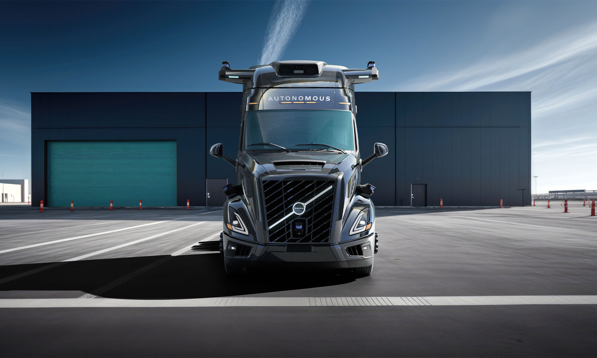
Vehicle maker Volvo and self-driving specialist Aurora have revealed their first production truck with full autonomous capabilities, after first announcing a partnership three years ago. The companies showed off the product of their collaboration, known as the Volvo VNL Autonomous truck, at the ACT Expo in Las Vegas.
The truck, which will be manufactured by Volvo, uses Aurora’s self-driving platform, known as Aurora Driver. The system uses multiple high-resolution cameras, LiDAR sensors and imaging radars, and can detect objects up to 400 meters away.
Aurora’s platform has already been driven billions of miles in training simulations, and around 1.5 million miles on real public highways. As well as a wide range of imaging and sensing technologies, the truck will also feature redundant steering, braking, communication, computation, power management, energy storage and vehicle motion management systems, ensuring it can operate safely alongside other road users.
Also Read: NETGEAR’s Orbi 970 Routers Offer Powerful Wi-Fi 7 Connectivity
When the first 20 Aurora autonomous trucks make their debut in North America next month, they will still be overseen by human drivers until testing is complete. Aurora intends to deploy trucks between Dallas and Houston in the near future, but it’s unclear whether the fleet will consist of Volvo machinery or vehicles from another partner.
Volvo announced at the Las Vegas event that it has already begun manufacturing a test fleet of the VNL Autonomous trucks at its New River Valley factory in Virginia. Nils Jaeger, President of Volvo Autonomous Solutions, explained that the truck was the “first of [the company’s] standardized global autonomous technology platform,” and added that it would enable Volvo “to introduce additional models in the future”.
News
Dubai Integrates LiDAR & Digital Twins For Road Management
The Road and Traffic Authority hopes to enhance road maintenance with faster, safer, and more accurate assessments.

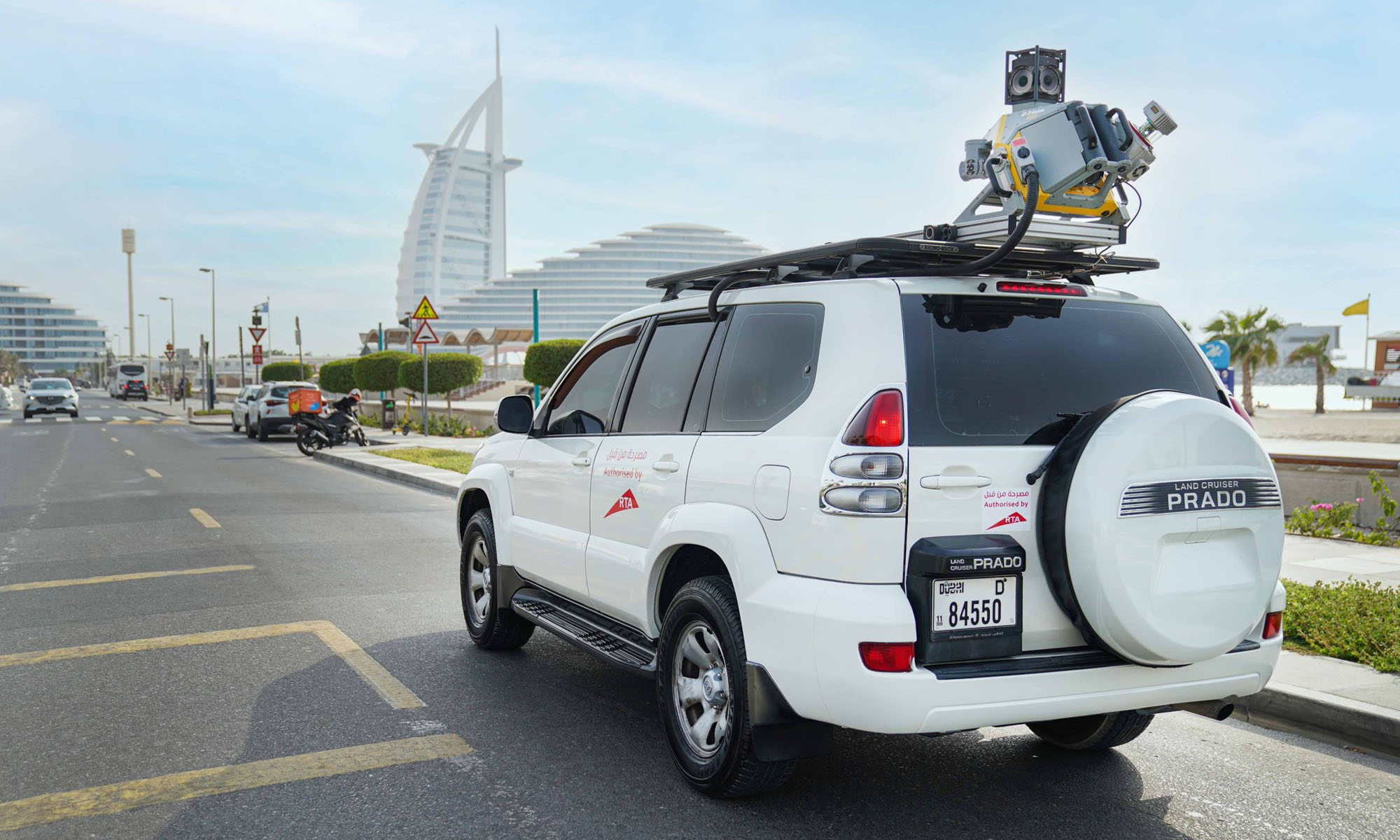
Dubai’s Roads and Transport Authority (RTA) is stepping up its road maintenance game by introducing LiDAR — short for Light Detection and Ranging — into its asset management system. This tech shift is part of a broader strategy to modernize how the city monitors and maintains its roads, using data-driven insights from digital twin platforms.
RTA has adopted the latest LiDAR (Light Detection and Ranging) technology to assess the condition of road assets and enhance the accuracy of data used in digital twin platforms. The initiative supports the development of preventive, predictive, and proactive maintenance… pic.twitter.com/8I7j9J9haw
— RTA (@rta_dubai) April 9, 2025
LiDAR isn’t new to the tech world, but RTA’s application of it marks a leap in how public infrastructure is managed. Instead of relying on slower, traditional visual inspections, lasers scan and map road conditions in real time. The result? Faster, more accurate data collection that feeds into advanced maintenance strategies — both preventive and predictive.
Hussain Al Banna, CEO of the Traffic and Roads Agency at RTA, highlighted the efficiency gains. “LiDAR technology delivers a remarkable boost in performance and speed, delivering up to 300% compared to traditional visual inspections,” he said. It’s a move that fits with Dubai’s broader vision of becoming a global model for smart, sustainable cities.
Accuracy is another key benefit. According to Al Banna, LiDAR offers up to 95% accuracy when assessing road conditions. This precision enhances the reliability of the data used for infrastructure decisions and helps streamline maintenance planning.
Also Read: Checkout.com Set To Launch Card Issuing In The UAE
LiDAR also enables safer inspections of high-up or hard-to-reach assets — think traffic lights, road signs, and lighting poles. This kind of efficiency isn’t just about numbers; it also reduces (or even eliminates) the need for manual labor in hazardous environments.
The scale of coverage is another game-changer. LiDAR will allow the RTA to scan around 80 kilometers of roads in a single day — a massive improvement compared to older methods, which typically cap out at 3 kilometers per day. Scanning can also be done on the move, at speeds between 30 and 100 km/h, helping to avoid road closures and traffic blockages.
Al Banna also emphasized the value of this real-time, high-resolution data in long-term planning: “This advanced technology delivers highly accurate data and detailed analysis of asset conditions, supporting the long-term sustainability of the Assets Condition Index (ACI)”. He noted that it helps in smart scheduling of maintenance, especially predictive tasks, by prioritizing based on strategic needs.


